Our History
Before the term "mesonet" was even conceived, Nebraska began its own network of weather stations in 1981. These five sites were focused on agricultural weather and research applications. As the value of this data to producers grew, and the importance of weather data for applications in other agencies and organizations expanded, the NE Mesonet consistently grew. Currently, the NE Mesonet consists of 63 stations, with a total of 73 expected by Fall 2024. Through funding from the United States Army Corps of Engineers, we will add another 10 stations in both 2025 and 2026. These sites will be located in the Upper Missouri River Basin, generally north of the Niobrara River. Additional funding and stations are also on the way for the rest of the state, so stay tuned for more updates!
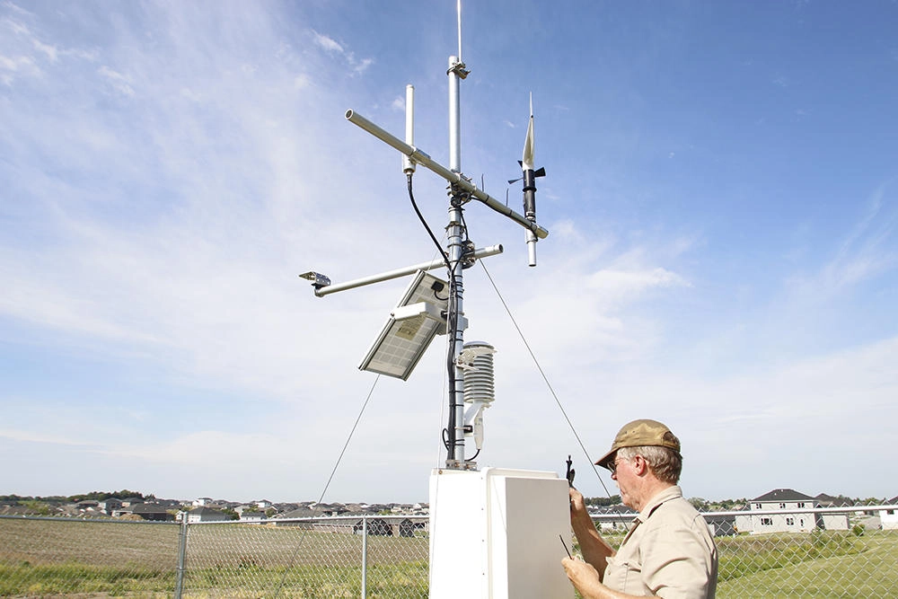
Observed Weather and Soil Variables
The NE Mesonet serves as an environmental monitoring network, including the following observations with their height and observation frequency.
AIR TEMPERATURE
10 m
2 m
1 minute
RELATIVE HUMIDITY
10 m
2 m
1 minute
WIND SPEED & DIRECTION
3 m
Direction of Gust
Standard Deviation of Wind Speed
1 minute
SOLAR RADIATION
2 m
1 minute
PRECIPITATION: SURFACE
STATION PRESSURE
2 m
1 minute
SNOW DEPTH/SNOW FALL: SURFACE
1 minute
SOIL MOISTURE & SOIL TEMPERATURE
5 minutes new
Water Content (m/m or fraction)
- New stations are receiving
2", 4", 20", 30", 40" sensors
- Legacy soil observations: Include 2", 4", 10", 20", 40" depths
BARE SOIL TEMPERATURE
4"
5 minutes
CAMERA(S)
Calculated Weather and Soil Variables
- Walter, et al. (2005). The ASCE Standardized Reference Evapotranspiration Equation. Evironmental and Water Resources Institute of the American Societyof Civil Engineers. Final Report.
Support
The network is supported by the State of Nebraska in collaboration with the Department of Natural Resources and the Institute of Agriculture and Natural Resources at the University of Nebraska Lincoln. Many agencies and individuals contribute to the network operations through service agreements for specific stations.